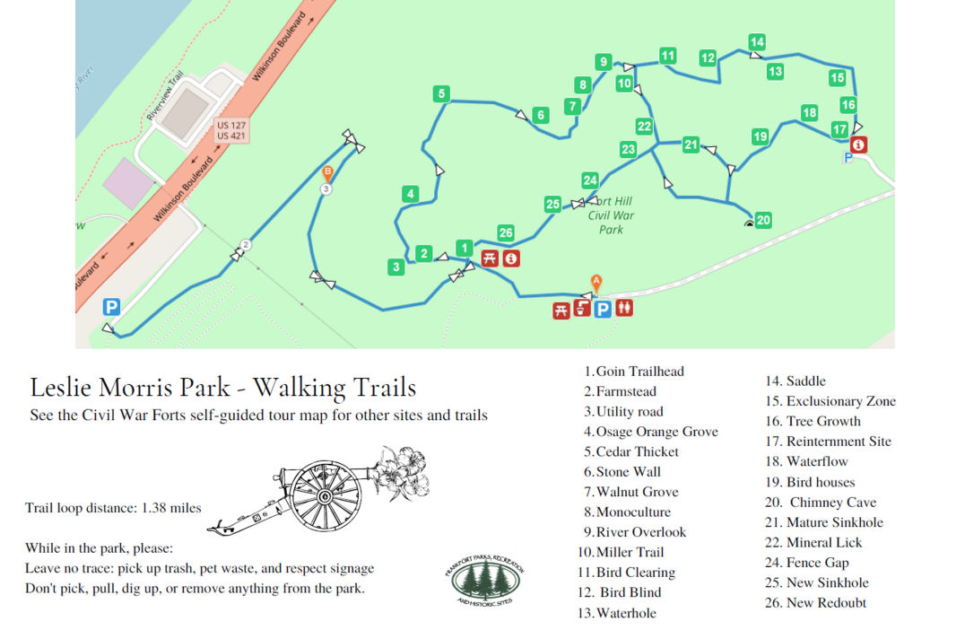
There are two, self-guided walking trails through the park. One trail highlights the Civil War forts (Fort Boone and the New Redoubt) and the other highlights some of the natural features of the park. Each map has corresponding numerical markers for the trails. There are printed maps available at stands near the entrance to the trails and at the Sullivan House Visitor's Center during regular operating hours.
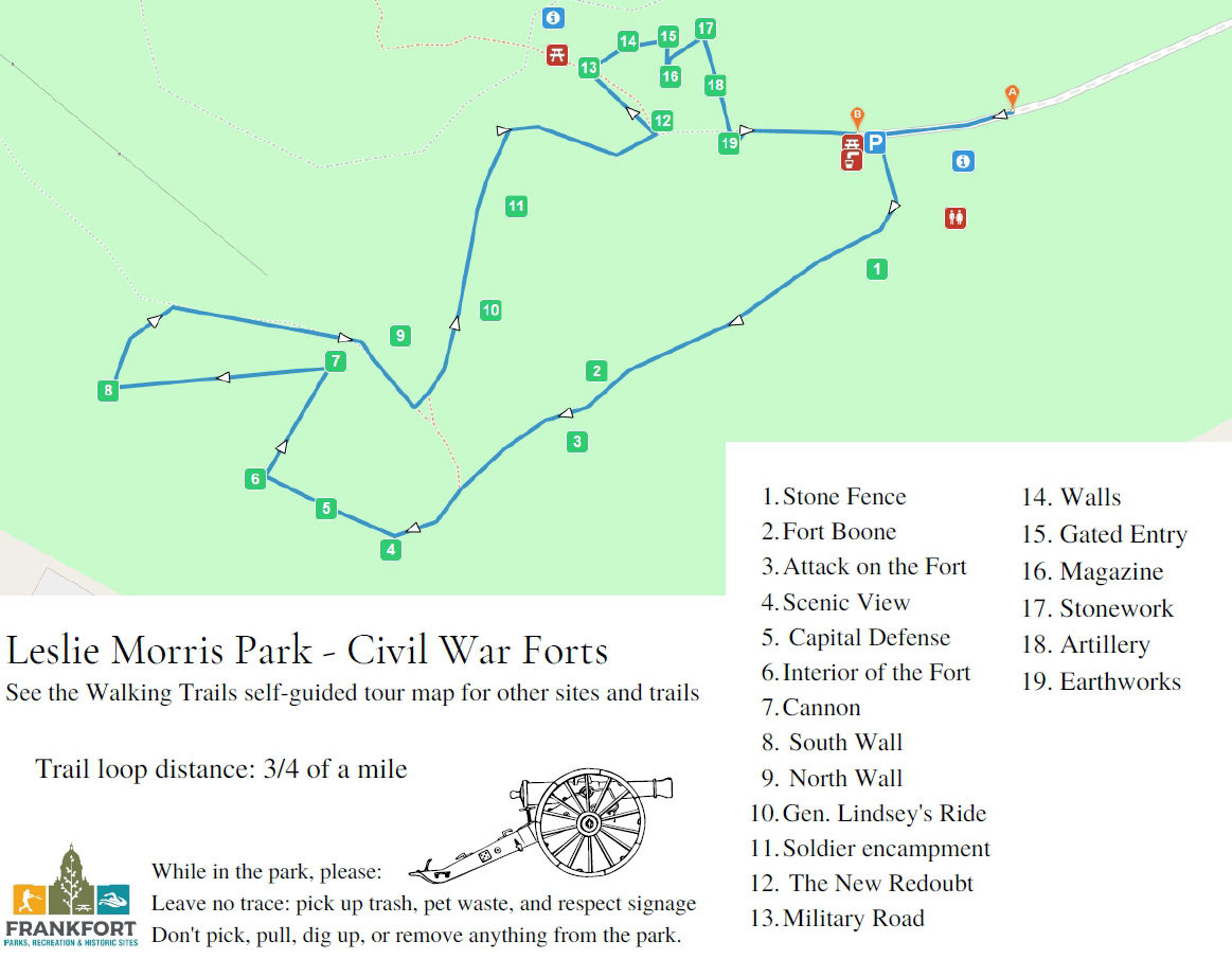
The map below highlights the historic features of the park, including the two forts. These trails are marked with red signs indicating the corresponding number on the map and the name of the location. The trail begins at the Sullivan House Visitor's Center. The majority of this trail is on paved or gravel paths. It is also the trail which highlights the downtown overlook.